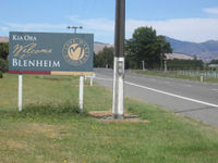
Blenheim, New Zealand
| Blenheim Waiharakeke (Maori) |
|
 Blenheim
|
|
| Population: | 30,200 (June 2010 estimate)[1] |
| Mayor: | Alistair Sowman |
| Territorial Authority | |
|---|---|
| Names: | Blenheim |
| Regional Council: | Marlborough District Council |
Blenheim is the most populous town in the region of Marlborough, in the north east of the South Island of New Zealand, and the seat of the regional council. It has a population of 30,200 (June 2010 estimate).[1] The area which surrounds the town is well known as a centre of New Zealand's wine industry. It enjoys one of New Zealand's sunniest climates, with hot, relatively dry summers and crisp winters.
The Marlborough Region in which Blenheim is situated has a wide range of leisure activities, from swimming with dolphins in the Marlborough Sounds to watching whales in Kaikoura; from walks through the bush and along the rugged coastline, as well as scenic boat cruising, fishing, water-skiing and kayaking. The relaxed lifestyle and the flourishing wine and gourmet food industry in Marlborough are enjoyed by both locals and visitors alike.
Blenheim is named after the Battle of Blenheim (1704), where troops led by John Churchill, 1st Duke of Marlborough defeated a combined French and Bavarian force.
Contents |
History
The sheltered coastal bays of Marlborough supported a small Māori population possibly as early as the 12th century. Anthropologists have christened this part of central Aotearoa, Waenganui, a region that stretched from inland Ureweras to Kaiapohia. Māori in the Marlborough Region cultivated crops, including kumara (sweet potato) and exploited marine resources.
Although the early history of Marlborough was closely associated with the Nelson settlement, the people of Marlborough wanted independence from Nelson. Nineteen years after the original Nelson settlement the request of Marlborough settlers was granted, and Marlborough became a separate province in 1859. Although gold was discovered in the province in the early 1860s the boom did not last and, while it helped to expand the region, the development of pastoralism provided the greatest long-term benefits. Marlborough squatters developed huge sheep runs that dominated the countryside, rivalling Canterbury's sheep stations in size and wealth.
Today the region's economy is still rurally based with pastoral and horticultural farming, providing a major source of income. The region's inhabitants continue to utilise the marine resources. Lake Grassmere is the country's only source of salt, and fishing and mussel farming are also extremely important in the region. Grape growing has been one of the fastest growing industries and Marlborough is now New Zealand's largest wine producing region, receiving worldwide recognition for its sauvignon blanc wines. Olive growing has also become popular in recent years.
The sunny, pleasant climate has attracted people to the region, either as holiday-makers or as permanent settlers. The region is especially popular among retired people, as well as people seeking an alternative lifestyle. Rapid population growth and other factors though have led to a contemporary chronic shortage of affordable housing for low and middle income earners.
Geography
Blenheim, situated on the Wairau Plain, is mostly flat with surrounding hills, which do not, however, give it as much protection from prevailing winds as might be expected. Open areas in and around Blenheim are hit quite hard by winds blowing in from Cook Strait. Blenheim sits at the confluence of the Taylor and Opawa rivers. Blenheim is in a tectonically active zone and experiences several (usually small) earthquakes each year. The boundary between the Pacific plate (on which Blenheim sits) and the Indo-Australian plate passes just north of Blenheim.
Climate
| Climate data for Blenheim | |||||||||||||
|---|---|---|---|---|---|---|---|---|---|---|---|---|---|
| Month | Jan | Feb | Mar | Apr | May | Jun | Jul | Aug | Sep | Oct | Nov | Dec | Year |
| Average high °C (°F) | 23.8 (74.8) |
23.6 (74.5) |
22 (72) |
19 (66) |
15.8 (60.4) |
13.3 (55.9) |
12.8 (55) |
13.8 (56.8) |
16 (61) |
18.1 (64.6) |
20.1 (68.2) |
22 (72) |
18.3 (64.9) |
| Average low °C (°F) | 12.5 (54.5) |
12.2 (54) |
11.4 (52.5) |
8.4 (47.1) |
5 (41) |
2.5 (36.5) |
2.1 (35.8) |
3.2 (37.8) |
5.5 (41.9) |
7.5 (45.5) |
9.6 (49.3) |
11.4 (52.5) |
7.6 (45.7) |
| Precipitation mm (inches) | 47 (1.85) |
27 (1.06) |
54 (2.13) |
64 (2.52) |
58 (2.28) |
56 (2.2) |
71 (2.8) |
70 (2.76) |
44 (1.73) |
70 (2.76) |
43 (1.69) |
54 (2.13) |
655 (25.79) |
| Source: NIWA Climate Data[2] | |||||||||||||
Based on the number of hours of sun recorded, in more recent years the title of "New Zealand's Sunniest Town" has gone to Blenheim. Historically, Nelson has been the Sunniest.
For the 2008 calendar year, NIWA (National Institute of Water and Atmospheric Research) which is New Zealand's "Crown owned research and consultancy company", states:
- "The sunniest centre in 2008 was Blenheim, recording 2505 hours, followed by Nelson with 2472 hours, then Lake Tekapo with 2444 hours"[3]
Demographics
| Historical population | |
|---|---|
| Census year |
Population |
|
|
|
| 1986 | 22,998 |
| 1991 | 23,787 |
| 1996 | 25,713 |
| 2001 | 26,550 |
| 2005 | 35,000 |
According to the 2001 census, Blenheim had a population of 26,550, a change of 3.3% since the 1996 census. The June 2010 estimate put Blenheim's population at 30,200.[1]
- Age
- 21.3% of people living in Blenheim were under 15, compared with 22.7% for all of New Zealand.
- 16.7% of people living in Blenheim were aged 65 years and over, compared with 12.1% for all of New Zealand.
- Education
- 28.7% of people aged 15 years and over had a post-secondary-school qualification, compared with 32% for New Zealand as a whole.
- Ethnic background
Most Blenheim residents are of European origin, predominantly of British, Irish, German and Dutch descent. Many of these people however, identify as Pakeha or New Zealanders rather than anachronistically refer to themselves as European. Small Māori, Pacific Island and Asian communities exist. Ethnic diversity has increased in recent years with the arrival of large numbers of South Americans (mostly Brazilians) and Asians (mainly Indonesian, Japanese, Korean and Filipino) who work in the expanding viticulture sector.
The 2001 New Zealand Census is dated now, but showed that in 2001, of people in the Blenheim Urban Area who actually completed the census forms (which are not available in either Japanese or Korean script):
- 94.4% belonged to the European or Pakeha ethnic group.
- 3.1% belonged to the Asian ethnic group.
- 1.1% belonged to the Māori ethnic group.
- 1.1% belonged to the Pacific Island ethnic group.
Economy
The Marlborough region is famous for its wine production, although other forms of agriculture are significant and the services sectors is also important.
With the growing international critical recognition of Marlborough Sauvignon Blanc, much of the wine industry has come to be dominated by large firms, owned by major New Zealand companies or offshore investors. Wages for most industry participants are low (around NZ$12-NZ$13/hour) and often calculated on a piece rate basis. Employment arrangements are often insecure and frequently not in accordance with New Zealand employment law. Agricultural land prices in the Wairau Valley have increased dramatically in value through the 1990s and 2000s.
Overall, income and wealth distribution in the town and wider region is highly uneven by New Zealand standards.
Education
The first school was opened in Blenheim in 1859. By 1875 there were three classes: Blenheim Upper Boys, Blenheim Lower Boys, and Blenheim Girls and Infants. A Blenheim High School was formed within the school in 1879.[4]
Catholic schools for boys and girls also were established in Blenheim in 1872. St Mary's Boys' school replaced it in 1886. In 1929, St Mary's was rebuilt after a fire.[5]
A coeducational secondary school called Marlborough High School was founded in Blenheim in 1900. It moved to the Marlborough Boys' College Stephenson Street site in 1901. In 1919 it changed its name to Marlborough College. The intermediate section was split to form Bohally Intermediate in 1956, and the girls moved to form Marlborough Girls' College in 1962, at which time the school took its current name.[6]
Marlborough Boys' College is a boys' secondary (years 9-13) school with a roll of 1006.[7] Marlborough Girls' College is a girls' secondary (years 9-13) school with a roll of 1029.[8] Both have a decile rating of 7.
The other schools in Blenheim are all coeducational.
Bohally Intermediate is an intermediate (years 7-8) school with a roll of 407 and a decile rating of 6.[9]
Blenheim School and Whitney Street School are contributing primary (years 1-6) schools with decile ratings of 3 and 5, respectively. Blenheim School has a roll of 81, and Whitney Street School has a roll of 248.[10][11]
St Mary's School is a state integrated full primary (years 1-8) school with a decile rating of 8 and a roll of 376.[12]
Other primary schools are in the suburbs of Redwoodtown, Witherlea, Mayfield, and Springlands, and in the surrounding localities of Fairhall, Grovetown, Rapaura and Riverlands.
The Nelson Marlborough Institute of Technology has a campus in Blenheim.[13]
Transportation
Air
Woodbourne Airport is a domestic airport and is also used by the RNZAF as an operational base. There are direct flights from Wellington, Christchurch and Auckland. Omaka Aerodrome, to the south of the city centre, is used solely by private and vintage aircraft pilots. An airshow (based mainly on World War I and II aircraft) is held at Omaka Aerodrome every two years on Easter.
Road
State Highway 1 runs through Blenhiem and State Highway 6 terminates at the junction of the two state highways. Blenheim is notable for a town of its size, in that it does not have traffic lights at any intersection. Instead, roundabouts were installed to speed arterial traffic flow. Since the installation of these roundabouts, traffic volumes have quickly increased and upgrading options are being considered, e.g. traffic lights, longer 2-lane approches and even a bypass.
Rail
Blenheim is on the northern section of the South Island Main Trunk Railway. A daily long-distance passenger service between Picton and Christchurch, the TranzCoastal, stops at the Blenheim Railway Station.
A major railway classification yard is located north of Blenheim at Spring Creek.
A heritage railway, the Blenheim Riverside Railway runs through the town.
Media
Blenheim is served by a variety of print publications. The major daily newspaper serving the Blenheim-Picton area is The Marlborough Express published by Fairfax NZ. The Marlborough Express' headquarters is in downtown Blenheim. The Saturday Express and Midweek are community newspapers published by the same company and distributed throughout Marlborough. The Blenheim Sun is a weekly newspaper distributed in Marlborough each Wednesday.
- Radio
This is a list of FM & AM radio stations in Blenheim. Note that the town can also receive most FM radio stations from the capital city of Wellington, across Cook Strait; these are not included in this list.
| FM Frequency | Nickname | Callsign | Format |
|---|---|---|---|
| 88.1 | The Shed | Classic rock | |
| 88.7 | Sunshine Radio | Easy listening | |
| 89.2 | Fresh FM Nelson | Alternative Community Radio | |
| 90.5 | ZM | Top 40 | |
| 91.3 | The Rock | Classic/Modern Rock | |
| 92.1 | Newstalk ZB | News/Talk | |
| 92.9 | MORE FM Marlborough | Adult Contemporary | |
| 94.5 | Radio Hauraki | Classic Rock | |
| 95.3 | Radio Live | News/Talk | |
| 96.1 | The Breeze | Easy Listening | |
| 96.9 | Classic Hits Marlborough | 2ZZE-FM | Classic Hits |
| 98.5 | Radio Sport | Sports/Talk | |
| 99.3 | Radio New Zealand Concert | Classical | |
| 101.7 | Radio New Zealand National | Public Radio | |
| 104.9 | The Edge FM | Top 40 | |
| 106.7 | Whisper FM | Nostalgia |
| AM Frequency | Nickname | Callsign | Format |
|---|---|---|---|
| 1539AM | Radio Sport | 2ZE-AM | Sports/Talk |
Events and points of interest
Omaka Aerodrome, south of the town centre, is the setting for the biennial Classic Fighters Marlborough airshow. The show, with a large emphasis on aircraft of World War One, has been held biannually since 2001, with the last show held over the weekend of 10–12 April 2009.
The Forrest Graperide is a 101 km (63 mi) cycle race held through the most picturesque scenery in Marlborough every autumn and is a big drawcard for cyclists all over New Zealand.
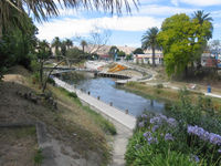
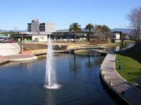
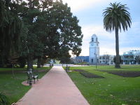
Seymour Square and Pollard Park are two of the town's main attractions for walks and general tourism.
The first weekend in February sees the festival "Blues, Brews and BBQ's", which comprises Blues and Jazz music, food and a variety of Beer and wine. It starts at 12pm and ends at 7pm, and its located at the A and P park near Redwoodtown. This is also followed the next weekend by the Wine & Food Festival, which brings all the regions great produce into one place.
The Wither Hills are just out of Blenheim and have many attractive walks found just off Maxwell Road. They are dry and arid and have seen many severe forest fires in the past.
The GCSB Waihopai communications monitoring facility, part of the ECHELON network, is situated near Blenheim.
References
- Reed, A. W. (2002). The Reed Dictionary of New Zealand Place Names. Auckland: Reed Books. ISBN 0-7900-0761-4.
- ↑ 1.0 1.1 1.2 "Subnational population estimates at 30 June 2010 (boundaries at 1 November 2010)". Statistics New Zealand. 26 October 2010. http://www.stats.govt.nz/~/media/Statistics/Methods%20and%20Services/Tables/Subnational%20population%20estimates/subnational-pop-estimate-jun2001-2010.ashx. Retrieved 26 October 2010.
- ↑ "Climate Data". NIWA. http://www.niwascience.co.nz/edu/resources/climate/. Retrieved November 2, 2007.
- ↑ http://www.niwa.co.nz/our-science/climate/publications/all/cs/annual/aclimsum_08
- ↑ A. D. McIntosh, ed (1940). Marlborough - A Provincial History. pp. 338–349.
- ↑ A. D. McIntosh, pp 328-329
- ↑ "Marlborough Boys' College - History". http://www.marlboroughboys.school.nz/About-Us/History.asp.
- ↑ "Te Kete Ipurangi - Marlborough Boys' College". Ministry of Education. http://www.tki.org.nz/e/schools/display_school_info.php?school_id=288.
- ↑ "Te Kete Ipurangi - Marlborough Girls' College". Ministry of Education. http://www.tki.org.nz/e/schools/display_school_info.php?school_id=289.
- ↑ "Te Kete Ipurangi - Bohally Intermediate". Ministry of Education. http://www.tki.org.nz/e/schools/display_school_info.php?school_id=2812.
- ↑ "Te Kete Ipurangi - Blenheim School". Ministry of Education. http://www.tki.org.nz/e/schools/display_school_info.php?school_id=2811.
- ↑ "Te Kete Ipurangi - Whitney Street School". Ministry of Education. http://www.tki.org.nz/e/schools/display_school_info.php?school_id=3071.
- ↑ "Te Kete Ipurangi - St Mary's School, Blenheim". Ministry of Education. http://www.tki.org.nz/e/schools/display_school_info.php?school_id=3012.
- ↑ "Marlborough Campus". Nelson Marlborough Institute of Technology. http://www.nmit.ac.nz/portal/TabID__3445/DesktopDefault.aspx.